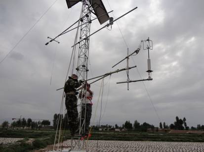
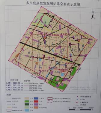
The open-circuit eddy system, soil moisture monitoring system and Bowenby system provided by our company were successfully installed in the Heihe Ecological Hydrological Remote Sensing Test Base in Zhangye City, Gansu Province in early June. The test base is located at 97°24′~102°10′ east longitude and 37°41′~42°42′ north latitude. It is the second largest inland river basin in China, originating from the middle section of Qilian Mountain and north to the Gobi Altai Mountains of Mongolia. It borders the Shiyang River Basin in the east and the Shule River Basin in the west. The total area is about 127,700 square kilometers, including different types of landscapes such as alpine ice and snow belt, forest steppe belt, plain oasis belt and Gobi desert belt. The Heihe River Basin is the base of research on the inland river basin of China. It has a good research foundation, a complete observation system and rich data accumulation.
The overall objective of the trial is to significantly improve the observing capabilities of the basin's ecological and hydrological processes, establish an internationally advanced watershed observing system, and improve the application of remote sensing in watershed eco-hydrological integration research and water resources management. It consists of basic tests, special tests, applied tests, product and method studies, and information systems.
1 Basic test: equipped with microwave radiometer, imaging spectrometer, thermal imager, laser radar and other aerial remote sensing equipment, to carry out a series of observations of key ecological and hydrological parameters; develop remote sensing forward model and inversion and estimation methods. A hydrological and meteorological comprehensive observation network covering the whole basin is formed to provide more representative model parameters, driving data and more accurate verification data for the basin ecological-hydrological model research. The wireless sensor network is constructed to measure the spatial heterogeneity of several key drivers, parameters and model states required for the eco-hydrological model. Conduct aerial remote sensing calibration and ground-based remote sensing experiments. Relying on the sensor network, supplemented by ground synchronization and encrypted observation, the authenticity test of remote sensing products is carried out.
2 Special test: Conducting "multi-scale surface evapotranspiration observation test for non-uniform underlying surface", using dense eddy correlation instrument, large aperture scintillator and automatic weather station observation matrix to reveal the spatial heterogeneity of surface evapotranspiration To achieve the scale expansion of non-uniform underlying surface evapotranspiration, develop and validate the evapotranspiration model to provide basic data.
3 Application test: Comprehensive observation experiments on snow and frozen soil hydrology, irrigation water balance, crop growth and ecological water consumption are carried out in the upper, middle and lower reaches of the basin, and the observation data and remote sensing products are used in the upstream distributed hydrological model. The surface water-groundwater-crop growth coupling model and the downstream ecological water consumption model in the middle reaches enhance the application of remote sensing in watershed eco-hydrological integration research and water resources management through empirical research.


JiangMen Jushu kitchenware co.,ltd , https://www.galaxstainless.com